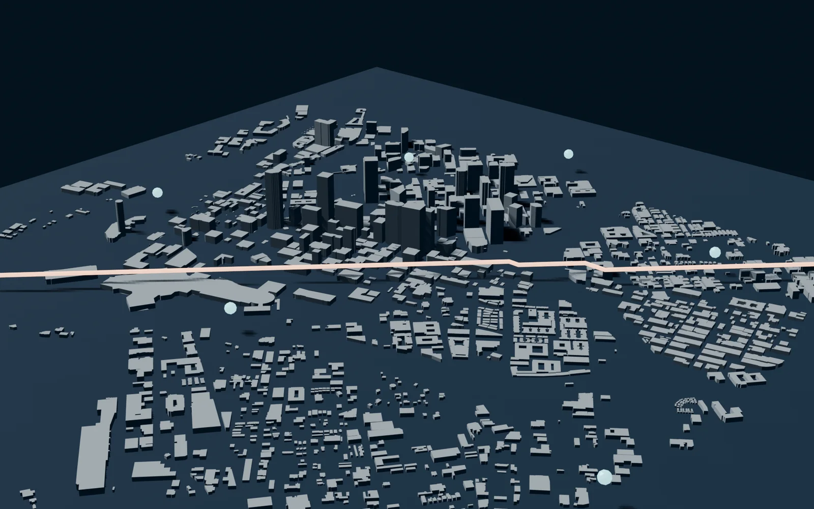
Dallas 3D turns 1,553 OpenStreetMap building footprints into a traceable LOD1-style city model, then uses the geometry for sampled visibility coverage and fixed-altitude path-planning experiments.
Stack, status, evidence, and public actions are rendered from the typed project record.
Category
Product System
Type
Experiment
Priority
Strong
Overview
What this project is
Dallas 3D turns 1,553 OpenStreetMap building footprints into a traceable LOD1-style city model, then uses the geometry for sampled visibility coverage and fixed-altitude path-planning experiments.
Problem
Why it matters
A visually varied city mesh is not enough for defensible geometry research when most building heights are missing and generated values are not traceable.
Solution
Approach
A reproducible pipeline that validates and projects OSM geometry, labels every height by provenance, exports an inspectable city mesh, and runs transparent 2.5D coverage and routing baselines.
Architecture
System shape and stack
Data Integrity
Uncertainty stays visible
Explicit OSM heights receive high confidence, levels-derived heights receive medium confidence, and the deterministic typology-and-area fallback remains labeled low confidence instead of manufacturing random high-rises.
Visibility
Coverage through real building prisms
A 2.5D ray test evaluates sampled aerial observer-to-ground-target lines against building footprints and heights, then a greedy set-cover baseline selects six observers with 93.33% sampled coverage.
Path Planning
Altitude changes the obstacle field
The fixed-altitude experiment rasterizes buildings that violate vertical clearance and applies eight-neighbor A* to produce a 4.99 km route with a 1.015× detour ratio.
Research Boundary
A geometry lab, not flight guidance
The project documents its flat-terrain, flat-roof, sampled-coverage, and fixed-altitude assumptions and does not claim legal, safe, continuous, or globally optimal UAV operation.
- Python
- GeoPandas
- Shapely
- Trimesh
- OSMnx
- Blender
- Pytest
- GitHub Actions
Technical Highlights
Visible technical signal
- Deterministic height enrichment with source and confidence on all 1,553 buildings
- Six greedy observer samples cover 93.33% of 240 sampled targets
- A* produces a 4.99 km route through an altitude-dependent obstacle grid
What It Proves
Builder signal
Ability to connect geospatial data engineering, computational geometry, algorithm design, 3D tooling, research boundaries, and reproducible presentation.
Boundaries
Context that should stay visible
Building footprints and tags © OpenStreetMap contributors, available under the ODbL.
Experiment metrics are reproducible outputs from the checked-in configuration. They are not real-world flight-performance claims.